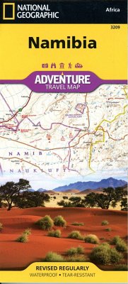
- Waterproof - Tear-Resistant - Travel Map National Geographic's Namibia Adventure Map is designed to meet the needs of adventure travelers with its detailed and accurate information. This map includes the locations of cities and towns with a user-friendly index, a clearly marked road network complete with distances and designations for roads/highways, plus secondary routes for those seeking to explore off the beaten path. The Namibia map also includes hundreds of marked private guest lodges, camps and, state-owned rest camps. Adventure Maps differ from a traditional road map because of the specialty content they include. Each map contains hundreds of diverse and unique recreational, ecological, cultural, and historic destinations -- outside of the major tourist hubs. National Geographic Adventure Maps are the perfect companion to a guidebook. Namibia is located on the south east shore of Africa. The climate is dry, even on the Atlantic coast where the dunes of the Namib Desert provide a spectacular sight. The eastern border of Namibia with Botswana, is defined by the Kalahari Desert. Despite the dry environment the protected areas of Namibia include almost 15 percent of the land area with virtually the entire Namib Desert coastal strip under protection. These protected areas are home to cheetahs, lions, zebras, giraffes, and even elephants. The northern part of the map includes the famous Skeleton Coast National Park. The the capital city of Windhoek falls in the generous overlap area of the printed map. The south side of the map includes Namib-Naukluft National Park as well as the Tsau//Khaeb (Sperrgebiet) National Park and, the long border with South Africa. Every Adventure Map is printed on durable synthetic paper, making them waterproof, tear-resistant and tough -- capable of withstanding the rigors of international travel. * Map Scale = 1:1,200,000 * Sheet Size = 25.5" x 37.75" * Folded Size = 4.25" x 9.25"
Hinweis: Dieser Artikel kann nur an eine deutsche Lieferadresse ausgeliefert werden.
Hinweis: Dieser Artikel kann nur an eine deutsche Lieferadresse ausgeliefert werden.


