29,99 €
inkl. MwSt.
Versandkostenfrei*
Versandfertig in 1-2 Wochen
payback
15 °P sammeln
  • Broschiertes Buch

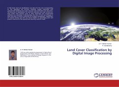
In this book, land use classification was done for the area corresponding to the toposheet 58 J/13.Two methods namely supervised and unsupervised methods were used. Ground truth verification was also done. The accuracy of classification for both the methods were also carried out. Area under each landuse cover in both supervised and unsupervised methods was calculated. Understanding the rate of land use changes in time and space is useful in planning for suitable management. Application of remote sensing and GIS was found helpful in quantifying past and present resources so that appropriate planning could be made.…mehr

Produktbeschreibung
In this book, land use classification was done for the area corresponding to the toposheet 58 J/13.Two methods namely supervised and unsupervised methods were used. Ground truth verification was also done. The accuracy of classification for both the methods were also carried out. Area under each landuse cover in both supervised and unsupervised methods was calculated. Understanding the rate of land use changes in time and space is useful in planning for suitable management. Application of remote sensing and GIS was found helpful in quantifying past and present resources so that appropriate planning could be made.
Hinweis: Dieser Artikel kann nur an eine deutsche Lieferadresse ausgeliefert werden.
Autorenporträt
I did my under graduate programme in Agricultural Engineering and Master degree in Farm Power and Machinery. I was worked as Design Engineer in the area of Agricultural Machinery.