36,99 €
inkl. MwSt.
Versandkostenfrei*
Versandfertig in 6-10 Tagen
payback
18 °P sammeln
  • Broschiertes Buch

This book maps the Land Use and Land Cover change in two coastal districts of Karnataka viz. Udupi and Dakshina Kannada using Remote Sensing and Geo Information System techniques. Multi-spectral scanner images from the Landsat Satellites during the period from 1973 to 2000 were chosen as the study images. The book looks into the impact of the Land Use and Land Cover Change, drivers of the change and the correlation between the drivers and the impacts. A prediction is also made for the expected Land Use and Land Cover in the year 2020 if the current trend continues. Finally an effort is made to…mehr

Produktbeschreibung
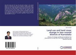
This book maps the Land Use and Land Cover change in two coastal districts of Karnataka viz. Udupi and Dakshina Kannada using Remote Sensing and Geo Information System techniques. Multi-spectral scanner images from the Landsat Satellites during the period from 1973 to 2000 were chosen as the study images. The book looks into the impact of the Land Use and Land Cover Change, drivers of the change and the correlation between the drivers and the impacts. A prediction is also made for the expected Land Use and Land Cover in the year 2020 if the current trend continues. Finally an effort is made to suggest ways of sustainable land management and also recommend appropriate locations for the upcoming SEZs in the area.
Autorenporträt
Apurve Gupta, B.E.(Honors) Electronics & Instrumentation from BITS Pilani, India. He has a keen interest in environment conservation and divides his time between his current role as a Product Manager at an e-commerce company and studying changes in the environmental landscape in India.