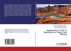
Mining industry require more time (up to tens of years) from prospecting stage to exploitation stage and have many operations including land ownership, exploration,borehole data management, volume computation, planning, production, site selection for dumping and waste rocks, transportation, safety, etc. Due to the advancement in the computer industry and information technology and evolution of Geographic Information Systems, the world is moving towards to automate the mining industry to overcome many traditional operations that require more time, effort and have many sources of errors. Therefore the objective of this book is to evaluate the potential of using GIS in operations of Egyptian surface mining. Two case studies are selected to deal with various operations. The first case study focused on phosphate ore deposit in Um Salamah area, El-Sibaiyyah, East Nile Valley, Egypt. The second case study focused on El-Gedida iron ore deposit in El-Baharia Oasis, Western Desert, Egypt.
Bitte wählen Sie Ihr Anliegen aus.
Rechnungen
Retourenschein anfordern
Bestellstatus
Storno

