Radioecology of Carbonatites in the Mt Homa region in southwest Kenya
Versandkostenfrei!
Versandfertig in 6-10 Tagen
47,99 €
inkl. MwSt.

PAYBACK Punkte
24 °P sammeln!
The level of radiation due to the naturally occurring radioactive materials was investigated and the radiological hazard was calculated for Mount Homa located at longitude 330 26' E and 340 34' E latitude 00 30' S and 00 20' S in southwestern Kenya. The absorbed dose rate in air above the ground was measured with hand held survey meters. The measured mean dose rate of 474 nSv/h translated to annual dose due to external radioactivity of 4.15 mSv/y. The radioactivity concentrations of K, Ra and Th in rock and soil samples were measured using gamma ray spectroscopy. The cumulative mean activity c...
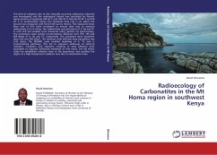
The level of radiation due to the naturally occurring radioactive materials was investigated and the radiological hazard was calculated for Mount Homa located at longitude 330 26' E and 340 34' E latitude 00 30' S and 00 20' S in southwestern Kenya. The absorbed dose rate in air above the ground was measured with hand held survey meters. The measured mean dose rate of 474 nSv/h translated to annual dose due to external radioactivity of 4.15 mSv/y. The radioactivity concentrations of K, Ra and Th in rock and soil samples were measured using gamma ray spectroscopy. The cumulative mean activity concentrations obtained were 915, 195 and 409 Bq/kg of K, Ra and Th, respectively. The calculated mean absorbed dose rate was 383 nGy/h. The resultant total effective dose equivalent was 5.03 mSv/y. The RESRAD code enabled modeling of K, Th and U environmental pathways. This led to exposure pathways of external radiation, inhalation and ingestion resulting in total effective dose equivalent to exposed individuals estimated as 4.93 mSv/y. The Mt Homa study has established radiation dose to the population and qualifies the region as a high background radiation area due to carbonatite rocks.


