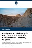
Broschiertes Buch
Konzentrationen, räumliche Verteilung, Beziehungen zu lokalen Erzverarbeitungsaktivitäten und Umweltauswirkungen
6. Dezember 2024
Verlag Unser Wissen
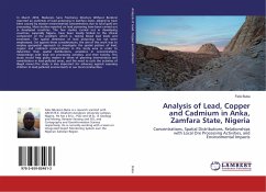
Broschiertes Buch
Concentrations, Spatial Distributions, Relationships with Local Ore Processing Activities, and Environmental Impacts
31. März 2016
LAP Lambert Academic Publishing
Broschiertes Buch
Concentrações, distribuições espaciais, relações com actividades locais de processamento de minério e impactos ambientais
6. Dezember 2024
Edições Nosso Conhecimento
Broschiertes Buch
Concentrations, répartition spatiale, relations avec les activités locales de traitement du minerai et incidences sur l'environnement
6. Dezember 2024
Editions Notre Savoir
Broschiertes Buch
Concentrazioni, distribuzioni spaziali, relazioni con le attività locali di lavorazione del minerale e impatti ambientali
6. Dezember 2024
Edizioni Sapienza
Broschiertes Buch
Koncentracii, prostranstwennoe raspredelenie, swqz' s mestnoj deqtel'nost'ü po pererabotke rudy i wozdejstwie na okruzhaüschuü sredu
6. Dezember 2024
Sciencia Scripts
Broschiertes Buch
Concentraciones, distribución espacial, relación con las actividades locales de tratamiento del mineral e impacto ambiental
6. Dezember 2024
Ediciones Nuestro Conocimiento
Ähnliche Artikel

Broschiertes Buch
Ein Rückblick auf die Jahre 1996-2016 in Nigeria Umwelt
12. Oktober 2022
Verlag Unser Wissen


23,99 €
Versandfertig in 6-10 Tagen
Broschiertes Buch
A Review as from 1996-2016 in Nigeria Environment
26. April 2018
LAP Lambert Academic Publishing

Broschiertes Buch
Allgemeine Aspekte und Grundsätze
26. September 2023
Verlag Unser Wissen
Broschiertes Buch
10. April 2024
Verlag Unser Wissen

Broschiertes Buch
18. August 2023
Verlag Unser Wissen
Ähnlichkeitssuche: Fact®Finder von OMIKRON
