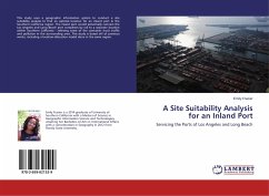
This book illustrates the Remote Sensing and Geographical Information System (GIS) based technique of Terrain Analysis for land suitability analysis. The various geo-physical processes of terrain attributes are digitally converted into raster formats. The digital raster layers are overlaid in GIS platform using Spatial Multi Criteria Evaluation (SMCE) Module. SMCE allows the standardization of raster data as per the requirement of goal i.e. Land Suitability Classification in this case. The output of SMCE synthesizes terrain information and carries out Land Suitability Classification on the basis of pre decided criteria i.e. land potentialities and limitations. Accordingly, three land suitability categories - Marginally Suitable, Moderately Suitable and Highly Suitable - have been derived. Thus, the entire parcel of terrain (land) is divided into different zones or categories each of which displaying varying degrees of potentialities and limitations for sustainable use. The illustrated land suitability analysis technique can be very useful for landuse planning and land management planning.
Bitte wählen Sie Ihr Anliegen aus.
Rechnungen
Retourenschein anfordern
Bestellstatus
Storno

