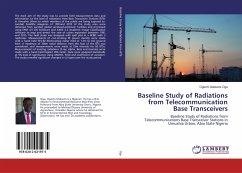
The main aim of the study was to provide field measurements data and information on the level of radiations from Base Transceiver Stations (BTS) in Umuahia Urban to which members of the public are being exposed to. Landsat Satellite imageries of 1991and 2015 of the study area were obtained from Landsat global Landuse/Lamdcover facilities and processed using ENVI 4.5 GIS Software and ILWIS 3.2 Academic Image Classification software to map and detect the rate of urban expansion between 1991 and 2015. The field study was designed with split plot in a RCBD with 3 replicates. Measurements of non-ionizing RF power density were made with a hand held TES-92 Electrosmog meter held at 1.5m to the ground level. A maximum of 300m radial distance from the foot of the BTS was considered, and measurements were made at 25m intervals for 60 BTSs. Measurements of ionizing radiations (X-ray, Alpha, Beta and Gamma) were made with a hand held Digilert 200 meter. Data were analyzed statistically at 5%level of significance using ANOVA, FLSD and Coefficient of variation. The study revealed significant changes in LU types over the study period.
Bitte wählen Sie Ihr Anliegen aus.
Rechnungen
Retourenschein anfordern
Bestellstatus
Storno

