35,99 €
inkl. MwSt.
Versandkostenfrei*
Versandfertig in 1-2 Wochen
payback
18 °P sammeln
  • Broschiertes Buch

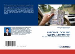
This book is meant for readers who are interested in studying the simple method of doing sensor fusion. It introduces the use of GPS, a camera and a magnetic compass in order to obtain the correction factor which will be used to draw the correct map for user of Google Earth software. With this method, the errors of Google Earth map can be computed for both translation and orientation errors. Alpha-cut methodology is a key for fusing all data from all sensors. Equations are presented in step by step that reader can easily apply to C++ or MATLAB programming software.

Produktbeschreibung
This book is meant for readers who are interested in studying the simple method of doing sensor fusion. It introduces the use of GPS, a camera and a magnetic compass in order to obtain the correction factor which will be used to draw the correct map for user of Google Earth software. With this method, the errors of Google Earth map can be computed for both translation and orientation errors. Alpha-cut methodology is a key for fusing all data from all sensors. Equations are presented in step by step that reader can easily apply to C++ or MATLAB programming software.
Hinweis: Dieser Artikel kann nur an eine deutsche Lieferadresse ausgeliefert werden.
Autorenporträt
C. Deelertpaiboon completed his BS and MS in Electrical Engineering from University of Wisconsin - Madison. His D.Eng was obtained from Asian Institute of Technology in Mechatronics. He is currently an instructor at King Mongkut''s University of Technology North Bangkok. His area of interest include sensor fusion, fuzzy logic, and control system.