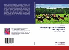
Different rangelands have different characteristics as indicated by soil features and vegetation patterns. These differences can be identified using remote sensing methods. The process based on using these differences as a base for remote sensing identification at different sites. Differentiation considered both spatial and temporal variations and hence data for different sites and times were used to achieve this. Since remote sensing can be used to distinguish between different characteristics of range sites, then could be used to assess and monitor rangeland in semi arid areas. Successful identification will help for assessment and monitoring large rangelands based on this principle. Justification is that terrestrial measurements and assessment for vast rangelands areas always require extensive efforts and high cost. Quantitative factors like biomass alone are not enough, therefore, more than one indicator were used like soil features and topographic features.
Bitte wählen Sie Ihr Anliegen aus.
Rechnungen
Retourenschein anfordern
Bestellstatus
Storno

