26,95 €
inkl. MwSt.
Sofort per Download lieferbar
  • Format: ePub

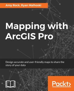
ArcGIS Pro is a geographic information system for working with maps and geographic information. This book will help you create visually stunning maps that increase the legibility of the stories being mapped and introduce visual and design concepts into a traditionally scientific, data-driven process. The book begins by outlining the steps of gathering data from authoritative sources and lays out the workflow of creating a great map. Once the plan is in place you will learn how to organize the Contents Pane in ArcGIS Pro and identify the steps involved in streamlining the production process.…mehr

Produktbeschreibung
ArcGIS Pro is a geographic information system for working with maps and geographic information. This book will help you create visually stunning maps that increase the
legibility of the stories being mapped and introduce visual and design concepts into
a traditionally scientific, data-driven process. The book begins by outlining the steps
of gathering data from authoritative sources and lays out the workflow of creating a great map. Once the plan is in place you will learn how to organize the Contents Pane in ArcGIS Pro and identify the steps involved in streamlining the production process. Then you will learn Cartographic Design techniques using ArcGIS Pro's feature set to organize the
page structure and create a custom set of color swatches. You will be then exposed
to the techniques required to ensure your data is clear and legible no matter the size
or scale of your map. The later chapters will help you understand the various projection
systems, trade-offs between them, and the proper applications of them to make sure
your maps are accurate and visually appealing. Finally, you will be introduced
to the ArcGIS Online ecosystem and how ArcGIS Pro can utilize it within the
application. You will learn Smart Mapping, a new feature of ArcGIS Online that will
help you to make maps that are visually stunning and useful.
By the end of this book, you will feel more confident in making appropriate cartographic decisions.

Autorenporträt
Dr. Amy Rock is a community geographer and an avid proponent of community leadership. Her research and projects include using GIS to examine economic relationships, economic accessibility, public participation in the federal block grant process, and commercial government GIS projects. She is currently teaching on the award-winning cartography program at Humboldt State University, and she is a director of their Online Geospatial Certificate Program.Ryan Malhoski is a GIS developer with over 10 years of GIS experience. He has a bachelor's degree in GIS and urban planning from Sacramento State University. He is currently a GIS developer for the City of Sacramento in the enterprise applications division. He spent over 6 years working for the U.S. Army Corps of Engineers as a geographer, where he was the GIS lead and project manager for multiple civil works and military projects. Ryan volunteers for Code for Sacramento, a brigade of Code for America, where he has volunteered for 2 years and just recently became Captain of the brigade.