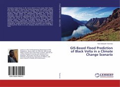
GIS-Based Flood Prediction of Black Volta in a Climate Change Scenario
Versandkostenfrei!
Versandfertig in 6-10 Tagen
36,99 €
inkl. MwSt.

PAYBACK Punkte
18 °P sammeln!
Increasing temperatures in the Lawra District of the Upper West Region (the driest region in Ghana) has caused devastating flash floods resulting from high intensity short duration rainfalls. These are characterized by annual mean rainfall intensities above 1000mm. However using Digital Elevation Model (DEM) for Hydrological Modelling and watershed delineation with remote sensing data and GIS techniques, for flood forecasting, requires an understanding of the basic relationships between rainfall and runoff for effective management of flood water. Eight Statistical tools; Time Series, Trend Ana...
Increasing temperatures in the Lawra District of the Upper West Region (the driest region in Ghana) has caused devastating flash floods resulting from high intensity short duration rainfalls. These are characterized by annual mean rainfall intensities above 1000mm. However using Digital Elevation Model (DEM) for Hydrological Modelling and watershed delineation with remote sensing data and GIS techniques, for flood forecasting, requires an understanding of the basic relationships between rainfall and runoff for effective management of flood water. Eight Statistical tools; Time Series, Trend Analysis, Moving Average, Weighted Moving Average, Exponential Smoothing, Percentage Growth and Seasonality, are statistical analyses conducted on 31 years of data each on temperature, rainfall and flow rates for their correlation and variability, in predicting these floods in an ever changing climate scenarios on the Black Volta.


